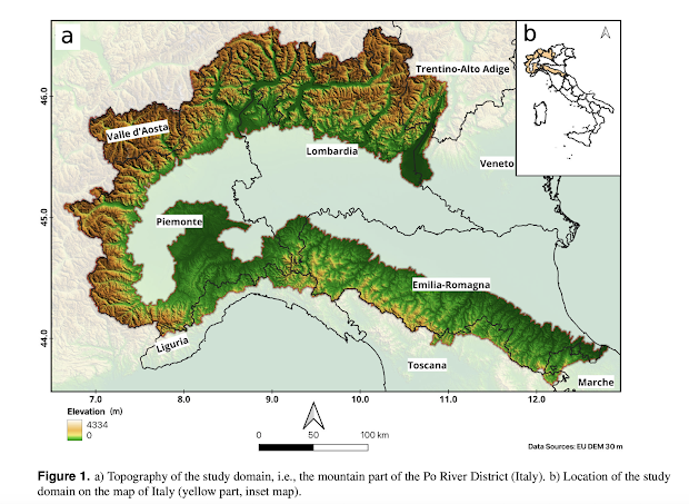
A rigorous quality assessment of the dataset has been performed at different control points selected based on reliability, quality, and territorial distribution. The point validation between simulated and observed snow depth across control points shows the accuracy of the dataset in simulating the normal and relatively high snow conditions, respectively. Additionally, satellite snow cover maps have been compared with simulated snow depth maps, as a function of elevation and aspect. 2D Validation shows accurate values over time and space, expressed in terms of snowline along the cardinal directions. This paper hase been submitted to Scientific Data. The preprint and all the indications to get the data is obtained by clicking on the Figure above. The definitive paper can be found at: https://www.nature.com/articles/s41597-025-04633-5. The paper contains all the references to recover the data.
My reflections and notes about hydrology and being a hydrologist in academia. The daily evolution of my work. Especially for my students, but also for anyone with the patience to read them.
Tuesday, September 10, 2024
30-years (1991-2021) Snow Water Equivalent Dataset in the Po River District, Italy
This paper presents a long-term snow water equivalent dataset in the Po River District, Italy, spanning from 1991 to 2021 at daily time step and 500 m spatial resolution partially covering the mountain ranges of Alps and Apennines. The data has been generated using a hybrid modelling approach integrating the hydrological modelling conducted with the physically- based GEOtop model, preprocessing of the meteorological data, and assimilation of in-situ snow measurements and Earth Observation snow products to enhance the quality of the model estimates.
Subscribe to:
Post Comments (Atom)

No comments:
Post a Comment